File:Cascadia map.jpg
Jump to navigation
Jump to search
Size of this preview: 401 × 599 pixels. Other resolution: 600 × 897 pixels.
Original file (600 × 897 pixels, file size: 128 KB, MIME type: image/jpeg)
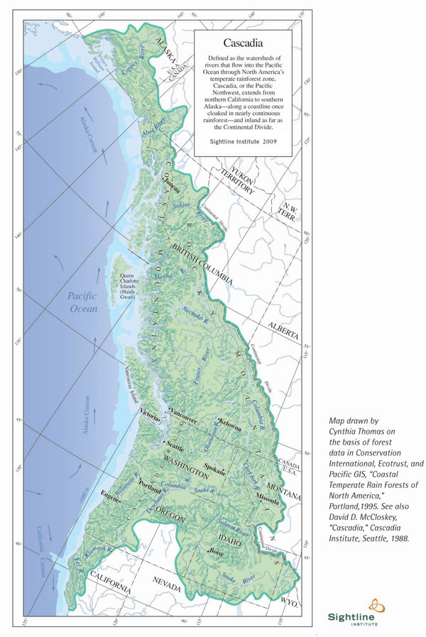
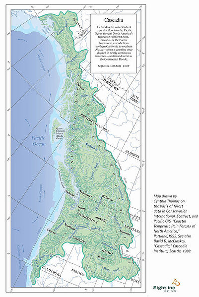
Sightline Institute's map of Cascadia.
File history
Click on a date/time to view the file as it appeared at that time.
| Date/Time | Thumbnail | Dimensions | User | Comment | |
|---|---|---|---|---|---|
| current | 20:39, 29 October 2010 | | 600 × 897 (128 KB) | WikiMaster (talk | contribs) | Sightline Institute's [http://www.sightline.org/maps/maps/cascadia_cs05m/cascadia_cs05m-med map of Cascadia]. |
You cannot overwrite this file.
File usage
The following page uses this file: