Mount Tabor: Difference between revisions
m (fix link) |
|||
| (One intermediate revision by one other user not shown) | |||
| Line 5: | Line 5: | ||
The City of Portland bought most of the land parcels on Mount Tabor in the late 19th century, in order to establish [[Portland City Reservoirs|reservoirs for Portland drinking water]] (storing water from the [[Bull Run Watershed]]). The reservoirs created there are mostly still in use, except for the one that was on the corner of [[SE 60th Avenue]] and [[SE Division Street]], which was decommissioned, and the land sold to a private residential facility, in the 1980s. | The City of Portland bought most of the land parcels on Mount Tabor in the late 19th century, in order to establish [[Portland City Reservoirs|reservoirs for Portland drinking water]] (storing water from the [[Bull Run Watershed]]). The reservoirs created there are mostly still in use, except for the one that was on the corner of [[SE 60th Avenue]] and [[SE Division Street]], which was decommissioned, and the land sold to a private residential facility, in the 1980s. | ||
It is also home to Mount Tabor Park, one of the larger parks in Portland, which was envisioned as part of a master plan for Portland parks by the famed [[Olmsted Brothers]] landscape architecture firm in 1903,<ref>http://www.portlandonline.com/bps/index.cfm?a=148061&c=44077</ref> and mostly implemented by [[Emanuel Mische]]. | It is also home to Mount Tabor Park, one of the larger parks in Portland, which was envisioned as part of a master plan for Portland parks by the famed [[Wikipedia:Olmsted Brothers|Olmsted Brothers]] landscape architecture firm in 1903,<ref>http://www.portlandonline.com/bps/index.cfm?a=148061&c=44077</ref> and mostly implemented by [[Emanuel Mische]]. | ||
On the southern side of the park, the [[Portland Parks and Recreation|Parks and Recreation]] department has its central maintenance facility, which serves all parks (and a number of other properties) in the city. | On the southern side of the park, the [[Portland Parks and Recreation|Parks and Recreation]] department has its central maintenance facility, which serves all parks (and a number of other properties) in the city. | ||
Latest revision as of 12:08, 17 December 2011

Mount Tabor is an extinct cinder cone volcano that is part of the Boring Lava Field. It is located in Southeast Portland, amid the neighborhoods of Mount Tabor, South Tabor, Sunnyside and Montavilla.
The City of Portland bought most of the land parcels on Mount Tabor in the late 19th century, in order to establish reservoirs for Portland drinking water (storing water from the Bull Run Watershed). The reservoirs created there are mostly still in use, except for the one that was on the corner of SE 60th Avenue and SE Division Street, which was decommissioned, and the land sold to a private residential facility, in the 1980s.
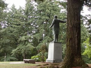
It is also home to Mount Tabor Park, one of the larger parks in Portland, which was envisioned as part of a master plan for Portland parks by the famed Olmsted Brothers landscape architecture firm in 1903,[1] and mostly implemented by Emanuel Mische.
On the southern side of the park, the Parks and Recreation department has its central maintenance facility, which serves all parks (and a number of other properties) in the city.